Legacy
xCraft has come a long way since 2014. Check out some of our legacy technology, now discontinued, that set the stage for the flying robots we create today.
XPlusone
The first drone we ever built, the XPlusOne was a first-of-it’s-kind VTOL aircraft. The drone would take off and land vertically, using all 4 props as a quad-copter, before transitioning into horizontal flight, much like a fixed-wing aircraft, reaching speeds of 60 MPH. The craft accepted a GoPro camera as a nose mount to capture aerial footage.
Features Included:
- Fully Autonomous Flight Plans: Plan your missions using a Google Maps-like interface and let the XPlusOne fly the entire mission, from takeoff to landing, without any user input.
- Follow-Me: Have the XPlusOne auto-follow your Android device using the included telemetry module and the Tower app.
- Return-to-Launch: When the battery is low, or the radio signal is lost, the PlusOne will automatically return to the launch position and land.
- Loiter Mode: Automatically holds GPS position and altitude for easy quad-copter flying.
- Auto-Land: Let the XPlusOne handle landings for you.
- Laptop or Tablet Control: In the field, direct the XPlusOne from your laptop or tablet.
- Expanded Polyolefin (EPO) Construction: A lightweight yet durable material allowing the XPlusOne to fly at maximum speed and strong enough to take a hit or two.


Technical Specifications
- Dimensions: 32.5 x 19 x 14 inches (82.55 x 48.26 x 35.56 cm)
- Flying Weight: 2.9 lbs (1350 g)
- Patent-Pending: Hybrid quad-copter flying wing design
- Speed: Hover – 60 mph (100 KM/H)
- Range: Approx. 2.5 miles from the transmitter
- Flight Time: Approx. 20 minutes
- Material: Expanded Polyolefin (EPO): A lightweight yet durable material
X2Q
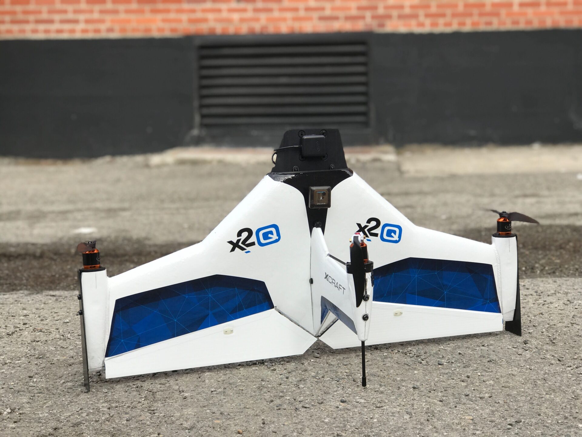
For high-definition geospatial mapping, we created the X2Q in 2018. The multi-rotor fixed-wing hybrid design enabled the craft to perform vertical takeoff and landing (VTOL) as well as long endurance forward-flight with data telemetry radio link range of up to 30 km.
The equipped Mapir Survey3 camera took high-resolution geo-tagged images, which could then be uploaded to the user’s preferred photogrammetry software and stitched into high-definition 2D or 3D maps.


Technical Specifications
- Takeoff and Landing: Vertical
- Maximum Flight Time: 25 Minutes
- Speed: 0-100 km/h (0-62 MPH)
- Wind Resistance: Up to 32 km/h (9M/S OR 20 MPH)
- Telemetry Radio Link Range: Data up to 30 km (18.6 miles), Video up to 20 km (12.4 miles)
- Maximum Coverage: (Single Flight) 16 km (4200 Acres) at 305 M (1000 ft) Altitude, 2.8 km (700 Acres) at 121 M (400 ft) Altitude
- Weight (Without Camera): 1.5 kg (3.3 lbs)
- Wingspan: 84 cm (33 in)
- Battery: 18.5V, 6000mAh
- Payload: 250g (0.55 lb)
- Camera Options: Mapir Survey3 RGB (12MP), EO/IR FLIR Boson with 3-Axis Gimbal
- Material: EPO Foam, Carbon and Aluminum
- Propulsion: 4 x 480W Brushless DC Motor
- Carry Case Dimensions: 89 x 50 x 20 cm (35 x 20 x 8 in)
- Flight Planning & Control Software: QGC or Mission Planner
Learn more about our history
If you have any questions or feedback regarding where we’ve come from or any of our past products, please reach out to us! We’re always happy to chat about our early innovations.
